
Mineral Resources, Technologies and Socio-Economic Development: Abundant occurrences of natural mineral resources can’t automatically lead to a country’s prosperity. Many nations, including Pakistan, are endowed with these mineral resources. Still, they struggle to turn these resources into drivers of economic and social progress. One of the key reasons for this is the failure to adopt modern scientific tools and techniques for resource exploration, development and management. A brief overview of how drones and Remote Sensing (RS) can be used by the mineral sector stakeholders in presented here.
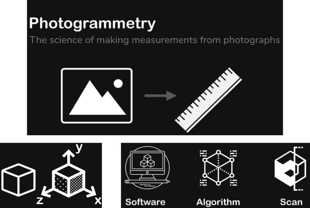
Photogrammetry: Aerial surveying using drones and applying photogrammetry techniques (the science of extracting accurate measurements and generating 3D models from photographs) can be used for 2D mapping and 3D modeling of mineral resources.
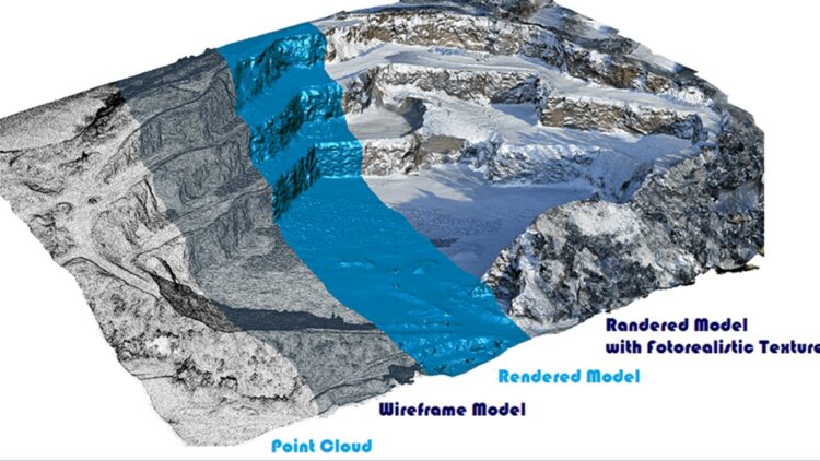
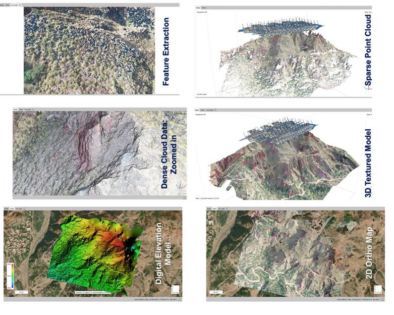
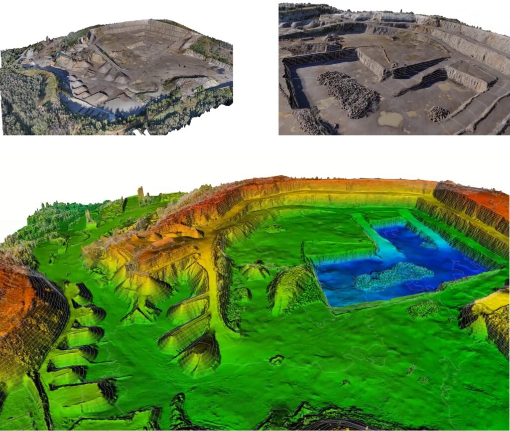
Using Drones and Photogrammetry in Minerals and Mining Industry: A simplified workflow of the process is presented in Figure 2. Multiple overlapping images are taken from drones to create detailed maps and models of the terrain and the surface geology of the potential mineral bearing areas. Drone mounted cameras and sensors are used to capture high-resolution aerial images. These images are then processed to study surface formations, identify mineral deposits, map geological structures, and analyze terrain. Drones provide a flexible, cost-effective, and efficient way to cover large or difficult-to-reach areas, offering real-time data collection and enhancing reconnaissance and mineral exploration surveys through advanced photogrammetry and remote sensing techniques.
Exploring Mineral Potential Using Remote Sensing: There is a broad use of remote sensing in the mineral industry from mineral exploration to mining and mineral beneficiation. Satellites and drones that are mounted with multispectral and hyperspectral camera scan capture the details that are diagnostic and used to identify minerals or mineral groups. Therefore, we can identify and quantify the mineral content using remote sensing. A conventional mineral exploration process, especially mineral mapping and the retrieval of surface compositional information, can become more effective and less time-consuming using drones and satellite imagery.
Benefits, Challenges and Way Forward: Benefits of using drones, photogrammetry and remote sensing includes increased efficiency, improved accuracy, and enhanced safety. These technologies enable rapid data collection, detailed 3D modeling, and real-time monitoring, allowing for better resource estimation, mine planning, and environmental management. However, challenges persist, such as data integration and interpretation, sensor limitations, regulatory hurdles, ensuring data accuracy and reliability, privacy concerns, and developing standardized workflows. Addressing these issues are essential to fully harness the potential of these technologies. Despite these challenges, the advantages of drones, photogrammetry, and geological remote sensing make them invaluable tools for optimizing mineral resource utilization and minimizing environmental impact.
The author is Assistant Professor at Military College of Engineering, National University of Sciences and Technology (NUST). He can be reached at [email protected].

![]()